Severe Tropical Cyclone Yasi, Australian for Katrina, has been upgraded to Australia's highest category, 5, with wind gusts of up to 300km/hr. the Australian Bureau of Meteorology's latest forecast warns:
SEVERE TC YASI IS A LARGE AND VERY POWERFUL TROPICAL CYCLONE AND POSES AN EXTREMELY SERIOUS THREAT TO LIFE AND PROPERTY WITHIN THE WARNING AREA, ESPECIALLY BETWEEN CAIRNS AND TOWNSVILLE.
THIS IMPACT IS LIKELY TO BE MORE LIFE THREATENING THAN ANY EXPERIENCED DURING RECENT GENERATIONS.
Yasi is forecast to come ashore with waves up to 40 feet and a storm surge over 20 feet tonight in Queensland near the town of Cardwell between 10pm and midnight.
Updated: 12:30 GMT Yasi's eyewall is coming ashore at midnight local time near Tully Queensland, south of Innisfail and north of Townsville. The coastline from Townesville to Innisfail will be devastated by a massive storm surge. Yasi is a minimum category 5 storm by U.S. criteria, according to objective satellite estimates, with sustained winds of approximately 156 miles per hour.


Yasi's winds are beginning to hit Queensland.
‘‘Some areas are already experiencing strong wind gusts up to 125km/h which will increase throughout the afternoon and evening,’’ Cairns Regional Council said in a statement.
‘‘Travelling by vehicle or on foot is unsafe. All evacuation centres are full and residents are urged to stay where they are now for the next 24 hours.’’
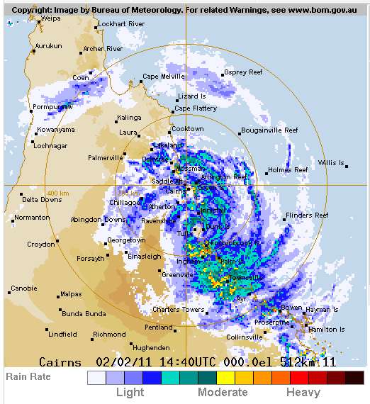
Update: Radar Link. Yasi has crossed the outer islands in the Great Barrier reef.
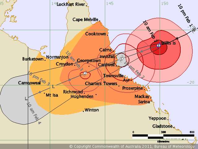
State disaster co-ordinator Ian Stewart said Cardwell could experience a storm surge of 6.5 to 7 metres above the normal high tide, and lives were at stake.
As a result, waves as high as 12m are predicted to hit the north Queensland coast putting tens of thousands of oceanfront and low-lying homes in Cairns and Townsville at risk of inundation
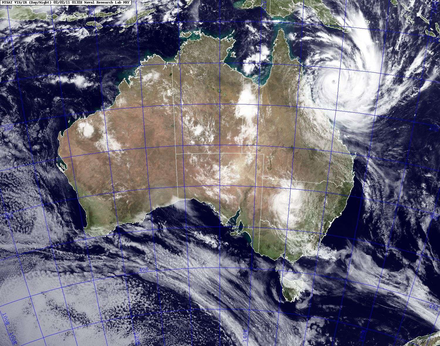
Yasi is a huge storm. (Click link for live blog of Yasi).
Liveblog from Cairns, resort town north of projected landfall.
The U.S. Navy has determined, using satellite based methodologies, that Yasi is a strong category 4 storm of 144 miles per hour on the U.S. Saffir- Simpson scale. Although it appears to me that Yasi's intensity has plateaued or peaked, the Navy is forecasting Yasi to intensify to 130 knots or 150 miles per hour before it makes landfall. The water is warm enough to support winds over 140 knots. By the Navy's reckoning, Yasi will make landfall at 150 mph, just 6 mph below category 5.
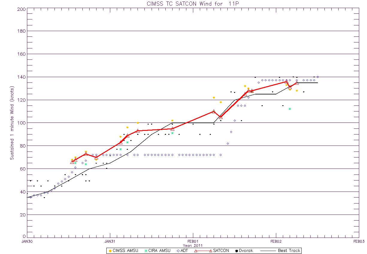
Updated 845am EST Feb 2, 2011: According to objective estimates Yasi is coming ashore at 135 to 140 knots, at or just over 156 mph, the lower limit for U.S. category 5 storms
Source: CIMSS
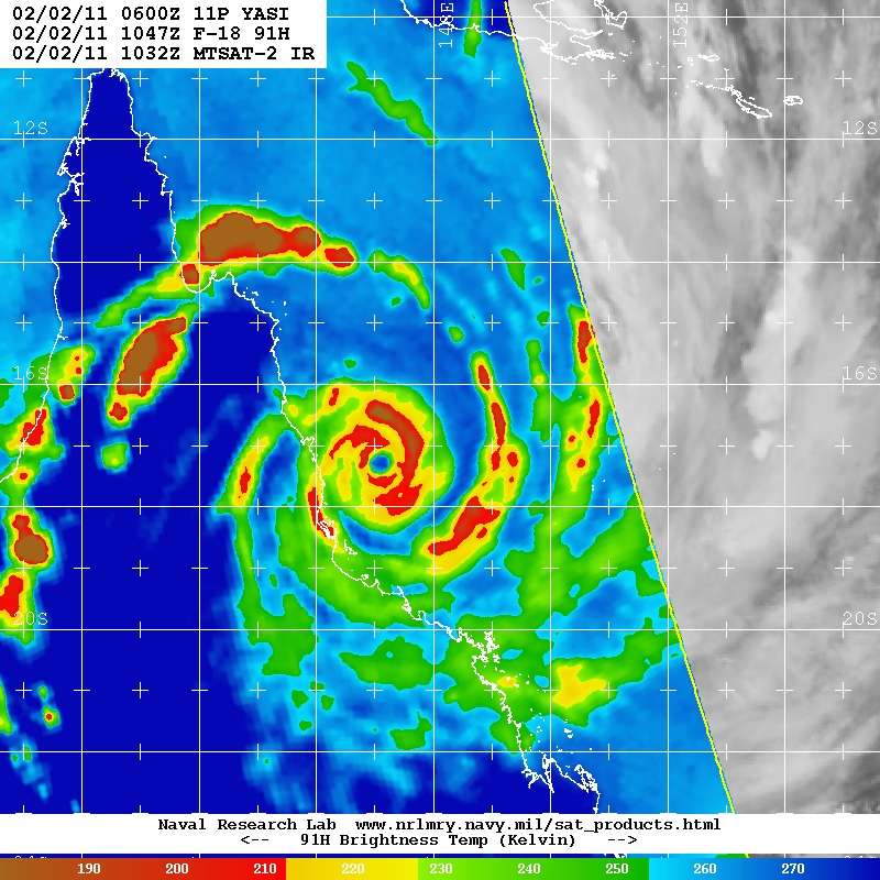
Satellite Microwave imagery shows Yasi's spiral bands several hours before landfall. Yasi has winds of about 155 mph at this time according to objective satellite methods.
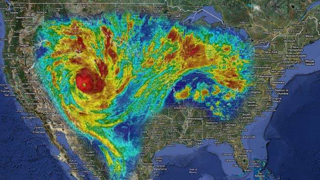
In size and strength Yasi is a lot like Katrina.
However, the damage should be much less than the damage in New Orleans because this part of Queensland has a moderate population density and , moreover, New Orleans is below sea level.
However, because Queensland has already suffered severe flooding, Yasi's floods will affect a much larger area than Katrina's floods.
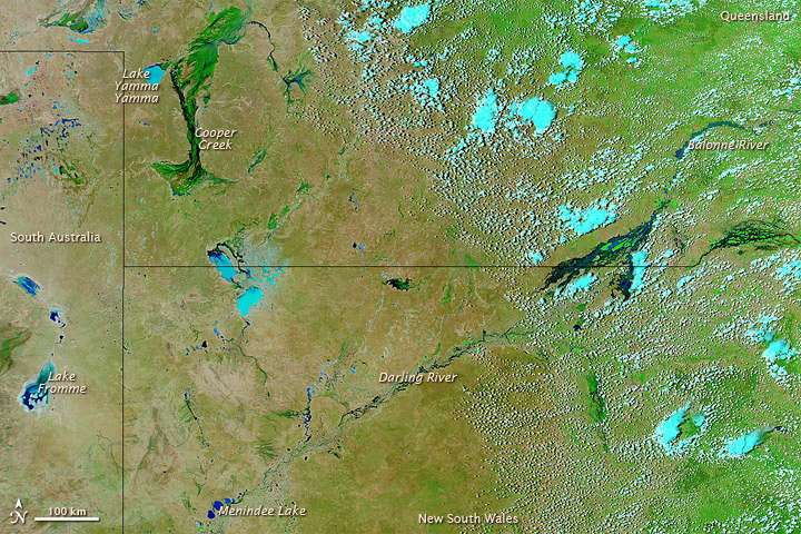
The outback in early January before the floods.
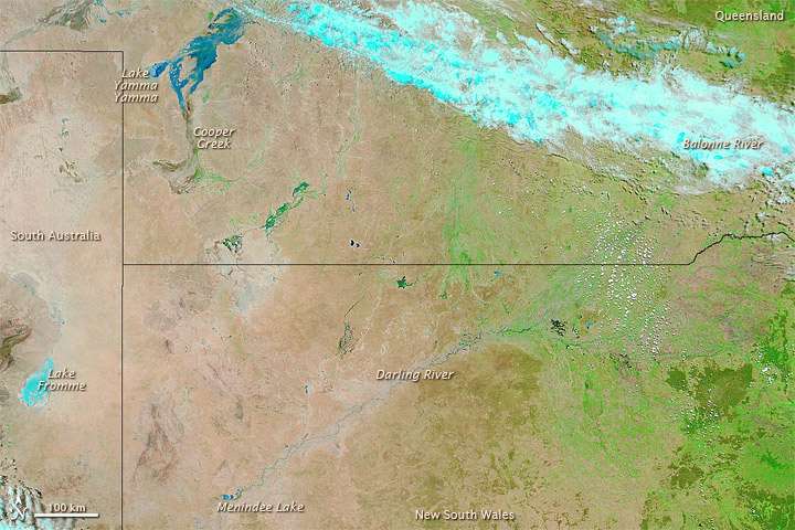
The outback in late January after the floods. Note that large lakes have formed.